
Local weather advisory
Coastal Flood Advisory: Commercial Roof Help in San Mateo
The National Weather Service has issued a coastal flood advisory covering San Mateo. Heavy rain and drainage loading can expose roof leaks, blocked drains, and ponding water. This is a weather exposure advisory; it does not establish damage to a specific roof.
Do not access a roof during hazardous weather. Protect people first, avoid water near electrical equipment, and request roofing help when conditions permit.
National Weather Service · Updated Oct 28, 2026, 7:20 AM UTC
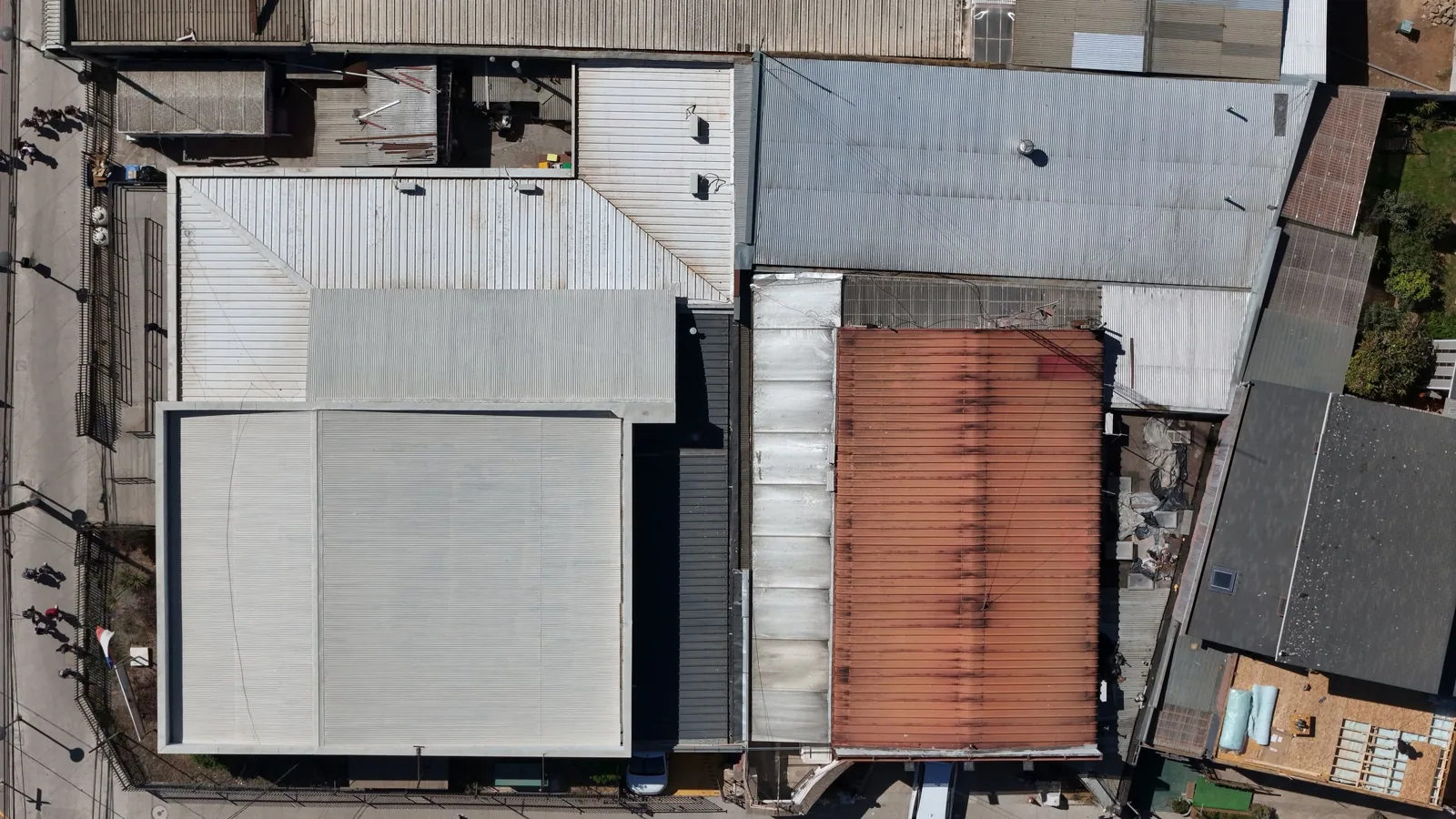
Drone Roof Inspection in San Mateo, CA
CATEGORY
Commercial Roofing Services
LOCATION
San Mateo, CA
Aerial imagery can show roof-wide patterns that are hard to see from a hatch, but it cannot test a seam or confirm concealed moisture. In San Mateo, mixed office and retail properties around Hillsdale, Bay Meadows, and Downtown may have equipment, setbacks, or access limits that shape the flight and roof walk. We define the question, confirm site permissions, and plan imagery around safe access. The deliverable ties views to roof zones and identifies where a closer inspection or test is still needed.
Inspection boundary: define the question first
A drone survey is most useful when the owner needs broad visual coverage, a record of roof geometry, or imagery of areas difficult to reach from the hatch. It can help locate debris, visible ponding, damaged panels, loose material, or blocked access paths. Before flying, agree on the buildings included, permitted flight area, privacy boundaries, and the decision the imagery should support. A flight without a defined question can create files without helping the maintenance plan.
Review property rules, airspace, local restrictions, weather, and site safety before scheduling. The operator needs an approved takeoff and landing area, clear separation from people, and an alternate plan if conditions change. A hands-on inspection remains necessary for close review of seams, flashings, and attachment. For a broad roof portfolio, mapped condition records can pair imagery with dated field observations.
When imagery is used to compare roof areas, keep the camera position, view direction, and scale as consistent as practical. A wide overview can establish the roof plane; a closer image can show the surface feature that prompted review. Use a plan reference or a visible landmark that does not expose tenant activity. Store the original capture date with the file, since a later repair, rain event, or equipment change can make an older image look current when it is not.
Assembly review: plan the flight around the building
Identify roof height, parapets, equipment, overhead wires, nearby operations, and any adjacent occupied areas. Set a route that captures the field, edges, drains, curbs, and obstructions without flying over people where avoidable. The operator should confirm permissions and applicable aviation rules rather than assuming a commercial roof survey is automatically clear. If a safe flight cannot be made, use an alternate access method and record the unobserved zone.
San Mateo's major circulation references include US 101, SR 92, El Camino Real, and Caltrain. They do not set airspace or property access rules. The site contact must still approve access, staging, and notice. A Hillsdale Station area survey needs its own flight boundary. The report should say when imagery was captured and which roof sections were outside the frame.
The owner should receive a concise list of what the flight did and did not observe. Low parapets can hide perimeter conditions, equipment can obscure a drain, and glare can wash out a membrane detail. The report should identify those limits and recommend an access method for the missing view. If the image suggests a concern but not its cause, schedule a field check instead of attaching a speculative repair quantity. A clear limitation is more useful to a project manager than a highly polished image with an unsupported diagnosis.
Sequence: capture images that can be located later
Use repeatable roof-zone labels, overview frames, and close views where resolution and safe standoff permit. Include a building reference or plan coordinate so a manager can match an image to a roof area. Note shadows, glare, standing water, obscured surfaces, and image distortion. Do not infer material type, wet insulation, or membrane attachment from a visual pattern that cannot support that conclusion.
The operator can capture edge conditions, equipment density, roof transitions, and visible debris; a technician should confirm details requiring touch, measurement, or test. A thermal moisture survey is a distinct method with its own conditions and verification steps. If an image suggests a split or open termination, a flashing inspection can determine whether repair is warranted.
Field detail: translate imagery into roof decisions
A useful report separates observation from interpretation. Label visible defects, assign a location, and state whether a hands-on review is needed. A broad image may show ponding but not explain the cause; a shadow can resemble a surface change; and a drain partially hidden by equipment may need a closer view. Preserve original files and map them to the plan so later visits can compare the same area.
San Mateo's drain design uses a two-inch hourly rainfall assumption. A view of an outlet does not verify its capacity or the condition beneath the strainer. An outlet review can add hands-on notes. A roof asset register can store dated imagery with site-level records while keeping property histories distinct.
Cost drivers: protect privacy and operating information
Set a collection boundary that avoids windows, work areas, and adjacent properties unless the owner has authorized that view. Limit delivery to the people who need the roof record, and use controlled file storage for high-resolution imagery. The flight plan should name the operator, site contact, scheduled window, access point, and any required escort. If a tenant changes operations or access, reschedule rather than capturing outside the approved boundary.
For an occupied building, notify the facility contact and establish a safe route below the survey area. San Mateo's economic base includes technology, finance, restaurants, and retailers, so protecting customer, employee, and operational information may matter alongside roof access. A building coordination plan can document notices and restrictions. Do not include private interior views in a roof deliverable unless specifically approved and needed.
Closeout: deliver the image set with limits
Provide dated overview and detail images, a roof-zone map, capture conditions, areas not seen, and recommended close inspections. Identify which observations remain unconfirmed. The client should be able to match each image to the same roof section used for repairs and maintenance. If an image supports a repair decision, schedule a hands-on review before assigning material or pricing concealed work.
The record is stronger when it pairs a flight with an inspection boundary and follow-up list. Commercial Roofing San Mateo can review the image set with the property manager and define which locations need direct access. For a Mariner's Island property, the building's own permissions and flight boundary govern. A drone is a coverage tool; the repair or replacement scope still depends on field verification and approved access.
A useful file set should be modest enough for a facility manager to review and structured well enough for a roofer to find a concern. Label images by building, elevation, roof plane, and capture date. Keep the original resolution available for close review, but provide a smaller set of selected views with a map and short observation notes. Identify visual obstructions and avoid marking an item as defective until an appropriate field inspection confirms it. This balance prevents a large image folder from becoming an unsearchable record.
Commercial Roofing Questions
Can drone images confirm a roof leak?
Images may locate visible damage or water patterns, but they cannot prove where water entered or whether concealed insulation is wet. Follow-up inspection or testing may be needed.
Do aerial views replace a hands-on inspection?
No. Close review of seams, flashings, attachment, and penetrations requires appropriate access. Drone imagery supplements the walk where broad coverage or safe standoff is useful.
What permissions are needed for a flight?
The operator should confirm property authorization, applicable airspace and aviation requirements, safe takeoff and landing areas, privacy boundaries, and site rules before scheduling.
What is included in the imagery report?
A roof-zone map, dated views, capture conditions, observed items, inaccessible areas, and recommended close inspections allow a facility team to use the files.
Can the imagery be compared over time?
Yes, when capture points, labels, and roof-zone references are recorded consistently. The comparison still needs current field observations before repair work is selected.
Discuss drone roof inspection in San Mateo
Share the roof plan, access rules, and current condition with Commercial Roofing San Mateo. We can define the inspection boundary and next field step for drone roof inspection.